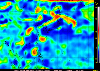

Tropical Depression 04W ( Caloy/98W)
- 15.4N 117.2E
- moving west @22 kph
- Maximum Wind Speed: 45 kph
- Gustiness Wind Speed: 65 kph
- Minimum Sea Level Pressure: 1004 mb
- Saffir-Simpson Typhoon Scale: Tropical Depression
- Projected Path: Towards south China Sea heading Southern China
Tropical Depression was spotted over the South China Sea at this moment.
It weakens this morning as it passes the Central Luzon's terrain last
night. As of this moment, intensification is possible within the next
12-24 hours reaching the tropical strength.It is anticipated to have
the wind speed of 65 kph-100 kph as it reorganizes over the South China
Sea. It is expected to turn west-northwest or northwest direction heading
Southern China including Hong Kong and Macau.Projected second landfall is
expected by early Thursday morning in the western part near Hong Kong.
While here in the Philippines, strong ITCZ rmains over the area of
Southern Luzon,Bicol, Mindoro, Visayas and rest of Mindanao. Scaterred
to widespread rains is expected along the affected the area while the
latest satellite shows an incoming cluster of thunderstorms and rains
along the eastern and southern part of Mindanao.
No comments:
Post a Comment