Thursday, November 25, 2010

Tropical Disturbance 94W moves toward Southern Vietnam..Tail-end of a Cold Front affecting Bicol Region

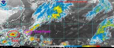
Based on the latest weather satellite imagery, Tail-end of a Cold Front affecting the Eastern Luzon and Bicol region. This region will experience mostly cloudy skies with isolated to scattered rains. showers and thunderstorms. Northeast Monsoon remains the dominant  disturbance that  brings cold weather temperature in Extreme Northern Luzon
* Residents along Mount Bulusan are alerted from possible lahar flows as possible rains that might trigger landslide along the mountain slope.

While weak to moderate Easterlies Wave now heading towards Eastern Mindanao. Possible rainshowers with thunderstorms also are expected as it moves toward Northern Mindanao and Southern Visayas.

Tropical Disturbance 94W remains disorganized as it moves toward Southern Vietnam. Possible intensification within the next 12 hours is still at 15%-25% (low chances).

Monday, November 1, 2010

PAG-ASA made an excellent job in tracking Typhoon Megi in the Philippines

PAG-ASA made a better job when they forecasts the expected projected landfall, bulletins and models during Tropical Cyclone Megi lashes Northern Luzon. Here are the total votes casted after the 10 days. More visitors rather to gave a positive score for PAG-ASA since they issued early warnings and bulletins before Typhoon Megi devastated Northern part of the country.


Enhanced by Zemanta

Government needs to provide a budget for this agency in order to have world-class facilities and instruments in order to provide an excellent weather forecasting in the science of meteorology.

We do hope that this better performance will improves not only today but in the near future.

Sunday, October 24, 2010

Tropical Storm Chaba rapidly gaining more strength as it moves toward the Okinawa area

Tropical Storm Chaba (Katring/16W)
As of 12 p.m. PST, October 25, 2010
  • 17.2N 130.6E
  • 1092.68 km. South-Southeast of Kadena AB, Okinawa, Japan
  • currently moving northwestward @ 11 kph
  • maximum sustained winds: 83 kph
  • gustiness winds: 102 kph
  • minimum sea level pressure: 992 MB
  • maximum sea wave height: 17 feet
  • heading towards Okinawa, Japan area
  • Saffir-Simpson Typhoon Scale: Tropical Storm
Latest satellite imagery depicts that Tropical Storm Chaba  has improved it's deep convection banding for the past 6 hours along the southern and western periphery of the low level circulation center (LLCC). Numerical weather guidance models support the intensification of this system within the next 2-3 days. On October 26. it shall anticipated to move NW-Northward @ 24 kph as a Typhoon (Category 1) with a maximum sustained winds of 130 kph. It shall resume it's  N-NNE track as it moves toward the Okinawa, Japan area on Thursday as a Typhoon (Category 2) with a maximum sustained winds of 158 kph/167 kph. It shall continue tracking it's NE direction as Category 1 system after passing Okinawa area late Saturday morning.

Precautionary measures must be properly implemented along the projected area.

Saturday, October 23, 2010

Tropical Depression barely moving Southwest @ 09 kph towards the Central Philippine Sea

Tropical Depression 16W (Katring) 
 As of 6 a.m. PST, October 24, 2010
  • 15.4N 132.8E
  • 1333.44 km. South-Southeast of Okinawa, Japan
  • currently moving westward @ 09 kph
  • maximum sustained winds: 56 kph
  • gustiness winds: 74 kph
  • minimum sea level pressure: 1004 MB
  • maximum sea wave height: 13 feet
  • heading towards Philippine Sea
  • Saffir-Simpson Typhoon Scale: Tropical Depression
Tropical Depression 16W continues to consolidate more strength as more numerical guidance models support the possible intensification of Tropical Depression 16W  in to a Tropical Storm within the next 12 hours (maximum sustained winds: 65 kph). It is anticipated to resume it's track beginning tomorrow in NW-WNW direction as a Tropical Storm and forecasts to accelerate on Tuesday at the speed of 24 kph with the possible sustained winds of  74 kph/93 kph/111 kph as it moves toward N-NNE heading Okinawa area on Thursday.

Friday, October 22, 2010

Typhoon Megi now on it's second lanfall towards Southeastern China..TD 16W on it's way to Philippine Sea..TD 17W trying to survives

Typhoon Megi (Juan/15W)
 As of 7 a.m. PST, October 23, 2010
  • 23.7N 118.1E
  • 425.96 km. East-Northeast of Hong Kong
  • currently moving northward @ 11 kph
  • maximum sustained winds: 130 kph
  • gustiness winds: 85 kph
  • minimum sea level pressure: 970 MB
  • maximum sea wave height: 21 feet
  • heading towards Southeastern China
  • Saffir-Simpson Typhoon Scale: Category 1
Typhoon Megi slowly decreasing it's strength as it is forecasts to make it's second landfall this afternoon. The main reason of weakening of this system is that it is tracking under the influence of moderate vertical wind shear and increased subsidence. Based on the latest satellite imagery , the central convection has shallowed and contracted towards the center and the large eye is completely cloud filled. Typhoon Megi is expected to dissipate within 12-18 hours once this sytem will make it's second landfall today.

Precautionary measures must be properly implemented along the affected area while Western Taiwan and Southeastern China are alerted against storm surge.

Cyclone updates regarding about Tropical Depression 16W and Tropical Depression 17W is found on the next page located above.
Enhanced by Zemanta

Tropical Depression 17W

Latest weather update will be issue around 8-10 a.m. PST, October 23, 2010

Thursday, October 21, 2010

Typhoon Megi now heading towards Southeastern China..Tropical Depression 16W gains more strength while 17W now a Tropical Depression


Typhoon Megi (Juan/15W)
  • 20.7N 118.0E
  • 435.22 km. East-Southeast of Hong Kong
  • currently moving north-northeastward @ 7 kph
  • maximum sustained winds: 167 kph
  • gustiness winds: 204 kph
  • minimum sea level pressure: 945 MB
  • maximum sea wave height: 34 feet
  • heading towards Southeastern China
  • Saffir-Simpson Typhoon Scale: Category 2
Typhoon Megi is expected to decrease it's strength as it becomes as a Category 1 within the next 12 hours with a maximum sustained winds of 130 kph. It is anticipated to move faster at 24 kph as it approaches the coast of Southeastern China beginning early tomorrow morning o it's second landfall as a Tropical Storm with the maximum sustained winds of 102 kph. It shall continue to move over the Zhangzhou Province where complete dissipation process is possible on Sunday.

Tropical Depression 16W
  • 17.3N 139.4E
  • 842.66 km. South of Iwo To, Japan
  • currently moving westward @ 19 kph
  • maximum sustained winds: 46 kph
  • gustiness winds: 65 kph
  • minimum sea level pressure: 1002 MB
  • maximum sea wave height: 10 feet
  • heading towards Philippine Sea
  • Saffir-Simpson Typhoon Scale: Tropical Depression
Tropical Depression 16W has consolidated strength for the past 6 hours as it moves toward westward. Latest satellite imagery depicts that Tropical Depression 16W is moving under the steering influence of the low-level subtropical ridged found to the north of the system. That is why, Tropical Depression 16W is expected to move westward within the next 72 hours and resume it's main track towards WNW on October 25.

PAGASA also reported that this system might enter the Philippine Area of Responsibility (PAR) on Saturday. Global numerical weather agency's such as ECMWF forecasts to move in W-WNW direction and did not run this system to affect the country but instead towards Okinawa, Japan area.

Tropical Depression 17W
  • 21.0N 155.7E
  • 1,444.56 km. Northeast of Hagatna, Guam
  • currently moving west-northwestward @ 17 kph
  • maximum sustained winds: 56 kph
  • gustiness winds: 74 kph
  • minimum sea level pressure: 1006 MB
  • maximum sea wave height: 10 feet
  • Saffir-Simpson Typhoon Scale: Tropical Depression
Tropical Depression 17W is expected to move in WNW direction and forecasts not to intensify signicantly within the next 24-48 hours. Unfavorable environmental factors such as upper level divergence, easterly vertical wind shear and the drier air that that moves toward in the center coming from the southeast region prevents the possible intensification. Complete dissipation process is possible within the next 48 hours.

Wednesday, October 20, 2010

Typhoon Megi weaken it's strength as it moves toward Southeastern China..95W now a Tropical Depression...while 98W consolidates more strength

As of 7 a.m. PST October 21, 2010


Typhoon Megi (Juan/15W)
  • 19.1N 117.5E
  • 509.3 km. Southeast of Hong Kong, China
  • currently moving north-northeastward @ 09 kph
  • maximum sustained winds: 185 kph
  • gustiness winds: 232 kph
  • minimum sea level pressure: 945 MB
  • maximum sea wave height: 38 feet
  • heading towards Southeastern China
  • Saffir-Simpson Typhoon Scale: Category 3
Typhoon Megi has gradually weaken it's strength over the past 6 hours however the latest IR imagery depicts an intense system with a banding eye and most of the convective band is found over the northwestern quadrant located over the South China Sea. Typhoon Megi is expected to decreasing it's strength as it moves to unfavorable environment and forecasts to move North-Northeastward direction in the 24-36 hours and resume it's track on October 22 as a Category 1 system (139 kph) as it approaches the coast of Southeastern China near Zhangzhou Province.

Proper precautionary measures must be implemented along the affected area. Strong storm surge is possible along the Northwestern seaboard coast of Luzon, Batanes and Western Taiwan is expected to prevail starting today as it moves to North-Northeastward direction.
Tropical Depression 95W (Pre-16W)

Joint Typhoon Warning Center has already issued Tropical Cyclone Formation Alert as Tropical Disturbance 95W rapidly gaining more strength for the past 12 hours.
  • 16.3N 146.7E
  • 148.16 km. Northeast of Saipan
  • currently moving west-northwestward @ 22 kph
  • maximum sustained winds: 28 kph
  • gustiness winds: 37 kph
  • minimum sea level pressure: 1006 MB
While here is the latest weather bulletin from the Japan Meteorological Agency for this newly develop cyclone:
  • 16.1N 144.8E
  • located over the Marianas
  • currently moving westward @ 17 kph
  • maximum winds near the center: 56 kph
  • DVORAK Intensity: Strong Tropical Depression
  • minimum sea level pressure: 1004 MB
  • forecast maximum winds near the center for the next 24 hours: 65 kph
PAGASA has already raised this system as a Tropical Depression and is anticipated to enter the Philippine Area of Responsibility (PAR) on Saturday. This system will be closely monitored por possible intensification.


Tropical Disturbance 98W
  • 17.6N 162.0E
  • 1092.68 km. Northwest of Kwajalein
  • maximum sustained winds: 22 kph
  • gustiness winds: 33 kph
  • minimum sea level pressure: 1006 MB
  • Saffir-Simpson Typhoon Scale: Tropical Disturbance
* Japan Meteorological Agency has already raised this active system as a Tropical Depression. Here is the latest weather update by this agency:
  • 17.0N 161.0E
  • moving West-Northwestward @ 19 kph

Tuesday, October 19, 2010

Typhoon Megi barely moving as it moves toward Southeastern China...95W now a threat as TC formation within the next 24-48 hours


Typhoon Megi (Juan/15W)
  • 17.2N 117.3E
  • 648.2 km. South-Southeast of Hong Kong, China
  • currently moving northwestward @ 6 kph
  • heading towards Southeastern China
  • maximum sustained winds: 213 kph
  • gustiness winds: 259 kph
  • minimum sea level pressure: 945
  • maximum sea wave height: 36 feet
  • Saffir-Simpson Typhoon Scale: Category 4

Typhoon Megi has rapidly gaining more strength for the past 6 hours and becomes as a Category 4 system (213 kph). Typhoon Megi is expected to move North-Northwestward direction within the next 2 days heading Southeastern China as it nears to Super Typhoon tomorrow approaching the east coast of Hong Kong (near Guandong Province late Friday morning)
Tropical Disturbance 95W
  • 16.3N 146.7E
  • 148.16 km. Northeast of Saipan
  • currently moving westward @ 22kph
  • maximum sustained winds: 28 kph
  • gustiness winds: 37 kph
  • minimum sea level pressure: 1006 MB
  • Saffir-Simpson Typhoon Scale: Tropical Disturbance
As of this moment, the potential for the development of a significant Tropical Cyclone Formation within the next 24-48 hours has already been raised to fair....65%-85% of becoming the next TC in the Western Pacific. This is the latest weather update also issued by the PAGASA based on the report of GMA News that this might become the next TC and affects the country early next week.

More updates once this system will fully-blown to an active Tropical Cyclone in the next coming days.

Friday, October 15, 2010

Typhoon Megi now entered PAR, rapidly intensification within the next 24 hours is expected as it moves toward Northen Luzon


Typhoon Megi (Juan/15W)
  • 17.0N 133.7E
  • 1444.56 km. East of Manila
  • currently moving northwestward @ 28 kph
  • maximum sustained winds: 176 kph
  • gustiness winds: 213 kph
  • minimum sea level pressure: 952 MB
  • maximum sea wave height: 27 feet
  • Saffir-Simpson Typhoon Scale: Category 2
  • heading towards Philippine Sea
Typhoon Megi rapidly gaining more strength as it moves WNW within the next 12 hours and becoming a Category 3 system (195 kph). It shall maintain it's present track within the next 24 hours as a Category 4 system (222 kph-241 kph) while resuming it's track to westward direction starting on October 17, Sunday. Latest numerical weather guidance models support the possible tracking of WSW direction tomorrow as a Super Typhoon/Category 4 system with a maximum sustaine winds of 250 kph and gustiness winds of 306 kph while approaching the coast of Extreme Northern Luzon specifically Northern Cagayan early evening of Monday. It is anticipated to transverse the Northern Luzon (Cagayan-Apayao area on Tuesday while moving 24 kph as a Category 1 system (148 kph) and is expected to be over the coast of ESE of Laoag, Ilocos Norte. Typhoon Megi is expected to lose it's strength due to mountaineous terrain where the system is crossing. It shall be over the South China Sea on October 19, while re-organizing and consolidating more strength with a project maximum sustained winds of 158 kph while heading WNW-NW ward in the direction of Hainan Island, China and rapidly gaining more strength.

As of this moment, proper precautionary measures must be implemented along the residents and visitors along Luzon especially Northern and Eastern coastline of Luzon down to Central Luzon.

Thursday, October 14, 2010

Typhoon Megi rapidly gaining more strength as it moves toward the Philippine Area of Responsibility tonight


Typhoon Megi (15W)
  • 13.5N 137.7E
  • 324.1 km. North of Yap
  • currently moving west-northwestward @ 11 kph
  • maximum sustained winds: 148 kph
  • gustiness winds: 185 kph
  • minimum sea level pressure:
  • maximum sea wave height: 22 feet
  • heading towards Philippine Sea
  • Saffir-Simpson Typhoon Scale: Category 1
Typhoon Megi has rapidly undergone intensification during the past six hours and is expected to consolidates more strength. Numerical weather guidance model supports the possible intensification within the next 12 hours as a Category 2 system (167 kph>) while moving in WNW direction heading the Central Philippine Sea. It shall maintain it's track while accelerating moving 24 kph starting tomorrow October 16 as a Super Typhoon (Category 4) packing the maximum sustained winds of 213 kph. It shall resume it's track to westward direction while maintaining it's strength as it approaches the coasts of Southern Cagayan-Isabela-Northern Aurora area peaking the maximum strength of 232 kph. It is anticipated to transverse the Extreme Central Northern Luzon (Kalinga-Benguet area) on October 18 and shall be on the coast of La Union-Lingayen area on October 19 as a Typhoon with the strength of 158 kph.

Tropical Disturbance 91W
  • 10.5N 131.2E
  • 5004.04 km. Northwest of Palau
  • maximum sustained winds: 22 kph
  • gustiness winds: 33 kph
  • minimum sea level pressure: 1007 MB
  • Saffir-Simpson Typhoon Scale: Tropical Disturbance
* Possible absorption of this disturbance as this system will be merge to the strong system north of it, Typhoon Megi.

Wednesday, October 13, 2010

Tropical Storm Megi rapidly gaining more strength as this will forecasts to absorb 91W and become Category 1 system today


Tropical Storm Megi (15W)
  • 11.6N 140.7E
  • 361.41 km. Northeast of Yap
  • currently moving westward @ 7 kph
  • maximum sustained winds:93 kph
  • gustiness winds: 121 kph
  • Saffir-Simpson Typhoon Scale: Strong Tropical Storm
  • minimum sea level pressure: 1002 MB
  • maximum sea wave height: 12 feet
  • heading towards Northern Caroline Islands-Philippine Sea
Tropical Storm Megi (15W) is expected to become as one of the strongest cyclone in the Western Pacific region based on the latest intensity and model issued by the different weather websites and agency's. One factor of the intensification is the possible absorption of TS Megi to the other disturbance located in the Philippine Sea (Tropical Disturbance 91W). The following below are the extended forecasts for Tropical Disturbance 91W:

Tropical Storm Megi is expected to become as a Category 1 this afternoon with a maximum sustained winds of 120 kph-139 kph while moving WNW-NW direction heading the Northern Caroline area. It shall maintain it's WNW to NW direction as it forecasts to move 24 kph on October15-16, 2010 as a Category 3 system (195 kph-204 kph). It is anticipated to resume it's track to NW-Westward direction as a powerful super typhoon on October 17-18, 2010 as a Category 4 (222 kph) while heading and approaching towards the coast of Southern Cagayan-Isabela area.

POSSIBLE AFFECTED AREA IN THE PHILIPPINES

This update is issued in order to identify the possible affected areas once the system will become a threat to any parts of the country.

Chances of Happening: Remains High (85%-100%)
  • Cagayan
  • Isabela
  • Kalinga Apayao
  • Aurora
  • Batanes
Chances of Happening: High (75%-95%)
  • Abra
  • Mountain
  • Benguet
  • Nueva Vizcaya
  • Ilocos Norte
  • Ilocos Sur
  • Polilio Island
  • Quirino
  • La Union
Chances of Happening: Medium-High (65%-85%)
  • Pangasinan
  • Zambales
  • Nueva Ecija
  • other parts of Central Luzon
  • other parts of Northern Bicol region
Chances of Happening: Moderate-Medium Chances (35%-55%)
  • more parts of Southern Luzon including Metro Manila
* More places might be raise as this might become a typhoon in the next coming days.

Tropical Disturbance 91W
  • 12.0N 132.0E
  • 583.38 km. North-Northwest of Palau
  • maximum sustained winds: 28 kph
  • gustiness winds: 37 kph
  • Saffir-Simpson Typhoon Scale: Strong Tropical Disturbance
  • minimum sea level pressure: 1008 MB
* There is a medium chances that this disturbance will be absorbed by the Tropical Storm Megi.

Tuesday, October 12, 2010

Tropical Depression 15W now develop...91W trying to consolidates more strength


Tropical Depression 15W
  • International Name: Pre-Megi
  • Philipppine Name: Pre-Juan
  • 11.4N 140.8E
  • 277.8 km. West-Southwesto f Guam
  • currently moving west-southwestward @ 13 kph
  • maximum sustained winds: 46 kph
  • gustiness winds: 65 kph
  • mimimum sea level pressure: 1006 MB
  • maximum sea wave height: 8 feet
  • Saffir-Simpson Typhoon Scale: Tropical Depression
Tropical Depression 15W is expected to consolidates more strength today reaching Tropical Storm strength with a maximum sustained winds of 65 kph. It shall move WNW-NW direction within the next 2-3 days. It shall maintain it's Tropical Storm strength until 48 hours and rapidly becoming a Category 1 system with a maximum sustained winds of more than 120 kph. It shall maintain it's strength in the next 24 hours while changing it's course to NW-Westward direction becoming a Category 2 system ( 158 kph) heading towards Extreme Northern Luzon.

* Entering landfall area of the said system is possible next week (October 19-20, 2010) along the coast of Southern Cagayan-Northern Isabela area.

Tropical Disturbance 91W
  • 11.6N 134E
  • 481.52 km. North of Palau
  • maximum sustained winds:19 kph
  • gustiness winds: 28 kph
  • minimum sea level pressure: 1010 MB
  • Saffir-Simpson Typhoon Scale: Tropical Disturbance
As of this moment, the potential for the development of a significant Tropical Cyclone remains medium high (55%-75%) as this system is trying to consolidates more strength.

Tropical Cyclone Formation is possible within the next 24-48 hours as Tropical Disturbance 90W gains more strength..91W has slightly organized


Tropical Cyclone Weather Outlook

Global numerical weather guidance model such as ECMWF is having a hard time to forecasts the next Tropical Cyclone in the Western Pacific.

But based on the latest bulletin issued, Tropical Cyclone Formation might be possible along the side of Eastern Luzon or Northwest of Guam on October 15, Friday. The latest system that might be the next Tropical Cyclone is Tropical Disturbance 90W since it is consolidating more strength unlike from 91W. The possible tendency would be, it will be absorbed by this strong circulation (90W) since as of this moment, any time from 24-48 hours Tropical Cyclone Formation is possible. If this would be the case, the system is expected to move WNW-NW direction on October 16-17, 2010 heading eastern coast of Northern Luzon. It shall be on the coast of Southern Cagayan-Northern Isabela area on October 18, Monday and might transverse the extreme Northern Luzon and forecasts to exit Ilocos Norte area on October 19, Tuesday as a Minimal-Strong Tropical Storm. It is anticipated to be on Northern South China Sea on October 20, Wenesday as it is expected to gain more strength and develop in to a Category 1-2 heading Southern China (Hong Kong area-Hainan Province:50:50 chances) until October 21, Thursday.

*This update is prior to change if certain new development happens.

Watch out for further updates as this will be closely monitored for development in the coming days. But here are the latest weather tropical disturbance update:

Tropical Disturbance 91W
  • 11.6N 134E
  • 481.52 km. North of Palau
  • the system has slightly organized for the past 6 hours
  • maximum sustained winds: 19 kph
  • gustiness winds: 28 kph
  • Saffir-Simpson Typhoon Scale: Tropical Disturbance
  • minimum sea level pressure: 1010 MB
* As of this moment, the potential for the development of a significant Tropical Cyclone Formation remains poor (45%-65%) based also on it's current and favorable environment for development.

Tropical Disturbance 90W
  • 12.0N 142.8E
  • 296.32 km. Southwest of Guam
  • maximum sustained winds: 28 kph
  • gustiness winds: 37 kph
  • Saffir-Simpson Typhoon Scale: Tropical Disturbance
  • minimum sea level pressure: 1007 MB
* As of this moment, the potential for the development of a significant Tropical Cyclone Formation has already been upgraded to fair (65%-85%). It means that intensification is possible as it was slightly consolidating more strength as the latest satellite imagery depicts a low level circulation center (LLCC) with an increased deep convection near the center of the system.
Sunday, October 10, 2010

Tropical Disturbance 99W reorganizing off the Philippine Sea


Tropical Disturbance 99W
  • 11.4N 129.6E
  • reorganized off the Philippine Sea
  • East of Surigao del Norte
  • maximum sustained winds: 28 kph
  • gustiness winds: 37 kph
  • minimum sea level pressure: 1010 MB
  • Saffir-Simpson Typhoon Scale: Tropical Disturbance
Based on the latest weather bulletin issued by the Japan Meteorological Agency, Tropical Disturbance 99W is currently moving northwest @ 19 kph (10 knots) heading Eastern Visayas with a minimum sea level pressure of 1008 MB.

Intensification within the next 6-12 hours as this system is trying to consolidate more strength. Watch out for further information regarding about this developing disturbance.

Weather Outlook:
Possible moderate to heavy rains ( more than 50%)
  • Western Visayas
  • Central Visayas
  • Eastern Visayas
  • Northern Mindanao

Saturday, October 2, 2010

Tropical Disturbance 92W regains more strength....now heading towards Central Vietnam


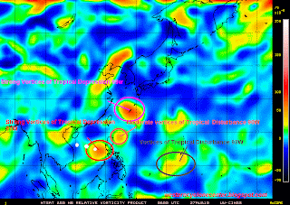
Tropical Disturbance 92W (ITOP24)
  • 12.4N 116.8E
  • 509.3 km. West-Southwest of Manila, Philippines
  • currently moving west-northwestward @ 19 kph
  • maximum sustained winds: 19 kph
  • gustiness winds: 28 kph
  • minimum sea level pressure: 1005 MB
  • heading towards Central Vietnam
* The status of Tropical Disturbance 92W has already been raised to fair which means anytime, within the next 24-48 hours, there is a possibility that it might become the next Tropical Cyclone in the Western Pacific. It is also because of the good outflow aloft and high sea surface temperatures.
*Possible Intensification will range from Minimal Depression-Minimal Tropical Storm based also on it's current environment and location tracking West-WestNorthwestward direction.

Wednesday, September 22, 2010

Typhoon Malakas regains more strength as it moves toward Iwo To-Chichijima area


Typhoon Malakas (13W)
  • 19.8N 141.0E
  • 546.34 km. South of Iwo To, Japan
  • currently moving west-northwestward @ 7 kph
  • maximum sustained winds: 120 kph
  • gustiness winds: 148 kph
  • Saffir-Simpson Typhoon Scale: Typhoon
  • minimum sea level pressure: 989 MB
  • maximum sea wave height: 23 feet
  • heading towards Iwo To-Chichijima area
Extended Forecast Outlook:

12 hours
  • 21.4N 140.7E
  • maximum sustained winds: 139 kph
  • gustiness winds: 167 kph
24 hours
  • 24.0N 140.9E
  • maximum sustained winds: 167 kph
  • gustiness winds: 204 kph
36 hours
  • 26.9N 141.8E
  • maximum sustained winds: 167 kph
  • gustiness winds: 204 kph
48 hours
  • 31.8N 144.4E
  • maximum sustained winds: 148 kph
  • gustiness winds: 185 kph
72 hours
  • 42.2N 154.5E
  • maximum sustained winds: 139 kph
  • gustiness winds: 167 kph
96 hours
  • 50.7N 167.9E
  • maximum sustained winds: 102 kph
  • gustiness winds: 130 kph
  • Extra-Tropical Cyclone
* All forecast outlook are taken from Joint Typhoon Warning Center

Tuesday, September 21, 2010

Tropical Storm Malakas/13W consolidating more strength as it moves closer to Iwo To-Chichijima area


Tropical Storm Malakas (13W)
  • 19.5N 142.5E
  • 601.9 km. South-Southeast of Iwo To, Japan
  • currently tracking west-northwestward @ 15 kph
  • maximum sustained winds: 74 kph
  • gustiness winds: 93 kph
  • Saffir-Simpson Typhoon Scale: Tropical Storm
  • minimum sea level pressure: 993 MB
  • maximum sea wave height: 15 feet
  • heading towards Iwo To- Chichijima area
Extended weather forecast:

  • Thursday -102 kph-Tropical Storm
  • Friday-139 kph-Typhoon/Category 1-expected to pass Iwo To area early morning
  • Saturday-158 kph-Typhoon/Category 2
  • Sunday-102 kph-Tropical Storm

Monday, September 20, 2010

Tropical Storm 13W (Malakas) gaining more strength...Tropical Wave approaching Eastern Philippines


Tropical Storm Malakas (13W):*Relocate
  • 18.4N 145.3E
  • 351.88 km. North of Saipan
  • currently moving west-southwesward @ 7 kph
  • maximum sustained winds: 65 kph
  • gustiness winds: 85 kph
  • Saffir-Simpson Typhoon Scale: Tropical Storm
  • minimum sea level pressure: 996 MB
  • maximum sea wave height: 12 feet
  • heading towards Iwo To-Chichijima area
Tropical Storm 13W is expected to move in westward-west-northwestward direction within the next 36 hours packing the maximum sustained winds of 75 kph-111 kph. It will then resume it's track to northeast-northnortheastward direction starting this Thursday peaking the wind speed of 139 kph (Category 1) towards Iwo To, Japan area. This coming Saturday, it is anticipated to pack the maximum sustained winds of 167 kph (Category 2) as it forecasts to remain its track in northnortheastward direction.

Proper precautionary measures must be implemented especially the Northern Marianas, Iwo To-Chichijima area and the rest small islands of Japan.

WEATHER UPDATE IN THE PHILIPPINES

Tropical Wave fastly approaching towards the Eastern coast of our country.

Possible affected area:
  • Bicol Region
  • Visayas
  • Mindanao
Proper precautionary measures must be prepared as this might bring widespread light-moderate rains with possible thunderstorms that would trigger flash floods and landslides.

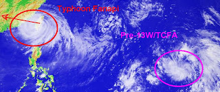
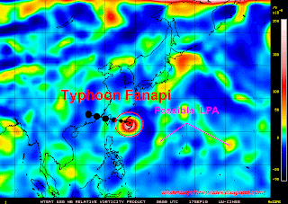
Typhoon Fanapi re-intesifies as it made its second landfall...Pre-13w rapidly gaining more strength


Typhoon Fanapi (12W/Inday)
  • 23.9N 117.6E
  • 388.92 km. East-Northeast of Hong Kong, China
  • currently moving west-northwestward @ 24 kph
  • maximum sustained winds: 120 kph
  • gustiness winds: 148 kph
  • Saffir-Simpson Typhoon Scale: Category 1
  • minimum sea level pressure: 970 MB
  • maximum sea wave height: 24 feet
  • heading towards Southeastern China
Tropical Cyclone Formation Alert 90W/Pre-13W
  • 18.0N 146.7E
  • 324.1 km. North-Northeast of Saipan
  • currently moving northwest @ 22 kph
  • maximum sustained winds: 28 kph
  • gustiness winds: 37 kph
  • minimum sea level pressure: 1007 MB
  • forecats for the next 12 hours: Minimal Tropical Depression

Saturday, September 18, 2010

Typhoon Fanapi now lossing it's strength as it transverse Central Taiwan, 90W now the subject for TCFA


Typhoon Fanapi (12W/Inday)
  • 23.7N 121.6E
  • 148.16 km. South of Taipei, Taiwan
  • now made on it's landfall
  • currently moving westward @ 26 kph
  • maximum sustained winds: 195 kph
  • gustiness winds: 241 kph
  • Saffir-Simpson Typhoon Scale: Category 2
  • minimum sea level pressure: 952 MB
  • maximum sea wave height: 28 feet
  • heading towards Taiwan Strait-Southeastern China
Typhoon Fanapi weakens it's strength as it made its landfallo ver the Eastern coast of Taiwan downgraded in to Category 2 disturbance. It is anticipated to resume its westward track this afternoon and will be expected to be in Taiwan Strait later tonight with the maximum sustained winds of 165 kph. Stormy weather with thunderstorm and storge surge is expected to affect across the island nation. Typhoon Finapi is expected to make it's landfall over Southeastern China later tomorrow morning and shall dissipate as low pressure over Guandong Province area.
Tropical Cyclone Formation Alert 90W/Pre-13W
  • 13.9N 151.2E
  • 675.98 km. East ofGuam
  • currently moving westward @ 28 kph
  • maximum sustained winds: 28 kph
  • gustiness winds: 37 kph
  • Saffir-Simpson Typhoon Scale: Tropical Disturbance
  • minimum sea level pressure: 1007 MB
  • maximum sea wave height: n/a

Typhoon Fanapi gains more strength as it moves toward Eastern Taiwan...90W develops


Typhoon Fanapi (Inday/12W)
  • 23.9N 124.3E
  • 305.58 km. East-Southeast of Taipei, Taiwan
  • currently moving west-northwestward @ 17 kph
  • maximum sustained winds: 195 kph
  • gustiness winds: 241 kph
  • Saffir-Simpson Typhoon Scale: Category 3
  • minimum sea level pressure: 944 MB
  • maximum sea wave height: 28 feet
  • heading towards Yaeyama-Taiwan (Eastern Coast)
Typhoon Fanapi is expected to maintain it's Category 3 strength as it makes its first landfall tomorrow early morning or noon along the eastern coasts of Taiwan. Proper precautionary measures must be properly implemented as this disturbance might cause storm surge along the affected area. Tomorrow afternoon, Typhoon Fanapi is anticipated to transverse Central Taiwan and move to Taiwan Strait with the Category 1 strength. It shall resume it's track in wesward direction towards the Southeastern coasts of China (Zhangzhou area) with the maximum sustained winds of 111 kph on Monday morning. Then, it is anticipated to dissipate over the mountaneous area of Guandong Province.
Tropical Disturbance 90W
  • 16.2N 154.0E
  • East of Northern Marianas
  • as of this moments it remains disorganized
  • currently moving West-Northwest slowly
  • maximum sustained winds: 28 kph (15 knots)
  • gustiness winds: 37 kph (20 knots)
  • Saffir-Simpson Typhoon Scale: Tropical Disturbance
  • 25%-45% chances of possible Tropical Cyclone Formation

Friday, September 17, 2010

Typhoon Fanapi rapidly gaining more strength..now heading towards the Eastern Coast of Taiwan


Typhoon Fanapi (Inday/12W)
  • 22.7N 128.0E
  • 703.76 km. East-Southeast of Taipei, Taiwan
  • currently moving northwestward 6 kph
  • maximum sustained winds: 139 kph
  • gustiness winds: 167 kph
  • Saffir-Simpson Typhoon Scale: Category 1
  • minimum sea level pressure: 967 MB
  • maximum sea wave height: 21 feet
Based on the latest weather satellite, Typhoon Fanapi is expected to move northwestward-west-northwestward within the next 24-48 hours. The recent satellite imagery depicts a developing irregular eye over the past 6 hours. Typhoon Fanapi is expected to accelerate windward heading and making it's first landfall over the Central Taiwan within the next 48 hours. It will continue tracking westward direction which could attain the strength of Category 2 while in the Taiwan Strait heading Southeastern Coast of China (Zhangzhou area) within the next 96 hours and shall dissipate over the border of Fujian-Guandong area.

Proper precautinary measures must be implemented along the affected and projected area.

Sunday, September 12, 2010

Tropical Disturbance 93w likely to become the next Tropical Cyclone


Tropical Disturbance 93W
  • 10.1N 134.9E
  • 277.8 km. North of Palau
  • maximum sustained winds: 19 kph
  • gustiness winds: 28 kph
  • minimum sea level pressure: 1007 MB
  • Saffir-Simpson Typhoon Scale: Tropical Disturbance
Global numerical weather models including NOGAPS, GFS, and ECMWF forecast a significant Tropical Cyclone Formation to develop from this area within the next 72 hours. More weather updates as this will be closely monitored for possible intensification.

Inter-Tropical Convergence Zone affecting NCR, Southern Luzon, Bicol Region, Visayas and Mindanao. Latest funktop weather imagery shows incoming rainfall with possible thunderstorms (+15mm/hr-+35mm/hr) heading towards Southern Mindanao. Proper precationary measures must be prepared along the said area.

Tropical Disturbance 93w likely to develop in to an active disturbance


Tropical Disturbance 93W
  • 10.8N 137.4E
  • near Southwest of Guam
  • maximum sustained winds: 28 kph
  • gustiness winds: 37 kph
  • minimum sea level pressure: 1010 MB

Friday, September 10, 2010

Tropical Disturbance 92w develops over South of Hong Kong..92w over the Western Pacific Ocean


Tropical Disturbance 91W
  • 8.0N 150.0E
  • maximum sustained winds: 28 kph
  • gustiness winds: 37 kph
  • minimum sea level pressure: 1010 MB
  • Stage: Warning
Tropical Disturbance 92W
  • 22.2N 116.4E
  • just south of Hong Kong or off South China Sea
  • maximum sustained winds: 28 kph
  • gustiness winds: 37 kph
  • minimum sea level pressure: 1010 MB
  • Stage: Warning
Watch out for further information about these developing disturbance.

Thursday, September 9, 2010

Tropical Storm Meranti has made it's landfall over Quanzhua, China...Western Pacific showing some potential active disturbance


Tropical Storm Meranti/11W
  • 25.7N 118.6E
  • 675.98 km. South-Southwest of Shanghai, China
  • currently moving northward @ 26 kph
  • has made it's landfall over Quanzhou, China
  • maximum sustained winds: 93 kph
  • gustiness winds: 120 kph
  • Saffir-Simpson Typhoon Scale: Tropical Storm
  • minimum sea level pressure: 985 MB
  • maximum sea wave height: 12 feet
12 hours ahead
  • 28.3N 118.8E
  • maximum sustained winds: 65 kph
  • gustiness winds: 83 kph
  • Tropical Depression-Tropical Disturbance
24 hours ahead
  • 30.3N 119.4E
  • maximum sustained winds: 37 kph
  • gustiness winds: 56 kph
  • Tropical Disturbance (Dissipating)
This would be the final bulletin of this system but still it would be closely monitored for possible regenerations.

Wednesday, September 8, 2010

Tropical Storm Meranti now heading towards Southeastern China (Fujian Province)


Tropical Storm Meranti (11W)
  • 21.3N 119.4E
  • 463 km. South-Southwest of Taipei, Taiwan
  • currently moving northeastward @ 11 kph
  • maximum sustained winds: 65 kph
  • gustiness winds: 83 kph
  • Saffir-Simpson Typhoon Scale: Tropical Storm
  • minimum sea level pressure: 996 MB
  • maximum sea wave height: 13 feet
  • heading towards Southeastern China (Fujian Province area)
12 hours ahead
  • 22.3N 119.5E
  • 74 kph-93 kph
  • Tropical Storm
24 hours ahead
  • 24.0N 119.1E
  • 74 kph-93 kph
  • Tropical Storm
36 hours ahead
  • 25.7N 118.3E
  • 64 kph-83 kph
  • Tropical Depression
48 hours ahead
  • 27.5N 118.0E
  • 37 kph- 56 kph
  • Tropical Disturbance
* Joint-Typhoon Warning Center

Tropical Depression 11w now developed and is expected to intensify within the next 12-24 hours...


Tropical Depression 11W
  • Local Philippine Name: Pre-Inday
  • International Name: Meranti
  • 21.3N 120.6E
  • 170.384 km. South-Southwest of Kaohsiung, Taiwan
  • 222.24 km. West-Northwest of Basco, Batanes
  • currently moving west-southwest @ 19 kph
  • maximum sustained winds: 56 kph
  • gustiness winds: 74 kph
  • Saffir-Simpson Typhoon Scale: Tropical Depression
  • minimum sea level pressure: 1000 MB
  • maximum sea wave height: 9 feet
  • moving towards Guandong-Fujian Province, China area
All weather websites and agency's are now monitoring the possible intensification of the newly developed disturbance. Numerical weather guidance models support the intensification to Tropical Storm within the next 12-24 hours.As of this moment, southern bands of circulation of Tropical Depression 11W is now affecting the small islands of Batanes, Calayan and Babuyan and Southern Taiwan bringing widespread rains and thunderstorms. It is expected to have the maximum sustained wind of 83 kph as it approaches the Southeastern coast of China and make landfall tomorrow evening. Complete dissipation process is anticipated on Friday morning over the mainland China. Proper precautions must be prepared for the upcoming tropical cyclone along the projected area.

Monday, September 6, 2010

Tropical Storm Malou now on it's becoming ExtraTropical Cyclone..Tropical Cyclone Formation for 90w is at 65%-85%


Tropical Storm Malou (Henry/10W)
  • 33.9N 128.7E
  • 120.38 km. Northwest of Sasebo, Japan
  • currently moving northeastward @ 19 kph
  • maximum sustained winds: 74 kph
  • gustiness winds: 93 kph
  • Saffir-Simpson Typhoon Scale: Tropical Storm
  • minimum sea level pressure: 993 MB
  • maximum sea wave height: 16 feet
  • heading towards Western Honshu
Tropical Disturbance 90W
  • 24.6N 124.4E
  • 388.92 km. West-Southwest of Okinawa, Japan
  • currently moving west-southwest slowly
  • maximum sustained winds: 19 kph
  • gustiness winds: 28 kph
  • minimum sea level pressure: 1005 MB
  • heading towards Eastern Coast of Taiwan
* Possible formation of Tropical Cyclone with in the next 24-48 hours is at 65%-85%. Latest numerical guidance model suggests the possible intensification of this disturbance.

Wednesday, September 1, 2010

Typhoon Kompasu now on it's landfall over Seoul, Korea..TS Lionrock regains more strength..93w might develop in to cyclone within the next 24-36 hours


Typhoon Kompasu (Glenda/08W)
  • 34.3N 124.8E
  • 388.92 km. South-Southwest of Seoul, South Korea
  • currently moving northward @ 37 kph
  • maximum sustained winds: 148 kph
  • gustiness winds: 185 kph
  • Saffir-Simpson Typhoon Scale: Category 2
  • minimum sea level pressure: 952 MB
  • maximum sea wave height: 19 feet
  • heading towards Korean Peninsula
Tropical Storm Lionrock (Florita/07W)
  • 23.1N 118.5E
  • 185.2 km. West-Northwest of Kaohsiung, Taiwan
  • currently moving westward @ 13 kph
  • maximum saustained winds: 93 kph
  • gustiness winds: 120 kph
  • saffir-Simpson Typhoon Scale: Tropical Storm
  • minimum sea level pressure: 982 MB
  • maximum sea wave height: 20 feet
  • heading towards eastern Guandong
Remnants of Tropical Depression Namtheun (LPA)
  • 24.5N 118.1E
  • 305.58 km. North-Northwest of Kaohsiung, Taiwan
  • currently moving west-southwestward @ 15kph
  • maximum sustained winds: 37 kph
  • gustiness winds: 56 kph
  • Saffir-Simpson Typhoon Scale: N/A
  • minimum sea level pressure: 1004 MB
  • maximum sea wave height: 08 feet
  • heading towards Taiwan Strait
Tropical Disturbance 93W
  • 12.8N 142.8E
  • 250.02 km. West-Southwest of Andersen AFB, Guam
  • maximum sustained winds: 19 kph
  • gustiness winds: 28 kph
  • minimum sea level pressure: 1009 MB
* More numerical weather guidance model shows the possible formation of an active cyclone within the next 24-48 hours.

Tuesday, August 31, 2010

TYphoon Kompasu & Tropical Storm Lionrock gains more strength..TS Namtheum expected to absorbed by the strong cyclone...93w and 93c closely monitored


Typhoon Kompasu (Glenda/08W)
  • 26.2N 128.5E
  • 83.34 km. East-Southeast of Kadena AB, Japan
  • currently moving northwestward @ 26 kph
  • maximum sustained winds: 176 kph
  • gustiness winds: 213 kph
  • Saffir-Simpson Typhoon Scale: Category 2
  • maximum sea wave height: 18 feet
  • minimum sea level pressure: 952 MB
  • heading towards East China Sea
Tropical Storm Lionrock (Florita/07W)
  • 20.4N 117.7E
  • 361.14 km. Southwest of Kaohsiung, Taiwan
  • currently moving East-Northeastward @ 04 kph
  • maximum sustained winds: 93 kph
  • gustiness winds: 120 kph
  • Saffir-Simpson Typhoon Scale: Tropical Storm
  • maximum sea wave height: 18 feet
  • minimum sea level pressure: 985 MB
  • heading towards Southwestern Taiwan
Tropical Storm Namtheun (09W)
  • 25.3N 120.1E
  • 148.16 km. West of Taipei, Taiwan
  • currently moving West-Southwestward @ 13 kph
  • maximum sustained winds: 65 kph
  • gustiness winds: 83 kph
  • Saffir-Simpson Typhoon Scale: Tropical Storm
  • maximum sea wave height: 10 feet
  • minimum sea level pressure: 996 MB
  • heading towards Taiwan Strait
Tropical Disturbance 93C
  • 9.9N 170.5E
  • 324.1 km. East-Northeast of Kwajalein Atoll
  • maximum sustained winds: 19 kph
  • gustiness winds: 28 kph
  • minimum sea level pressure: 1007 MB
* already raised by the Japan Meteorological Agency as Tropical Depression
* already passed the International Date Line


Tropical Disturbance 93W
  • 9.1N 145.9E
  • 509.3 km. South-Southeast of Guam
  • maximum sustained winds: 19 kph
  • gustiness winds: 28 kph
  • minimum sea level pressure: 1009 MB

Monday, August 30, 2010

Western Pacific now becoming active as Typhoon Kompasu, Tropical Storm Lionrock, Tropical Depression 09W and Tropical Disturbance 93w develops


-----------------------------------------
Typhoon Kompasu (Glenda/08W)
-----------------------------------------
  • 23.3N 131.8E
  • 509.3 km Southeast of Okinawa, Japan
  • currently moving northwestward @ 09 kph
  • maximum sustained winds: 120 kph
  • gustiness winds: 148 kph
  • Saffir-Simpson Typhoon Scale: Category 1
  • maximum sea wave height: 16 feet
  • minimum sea level pressure: 974 MB
  • heading towards Ryukyus-Okinawa, Japan area
_______________________________________________________
Tropical Storm Lionrock (Florita/07W)
  • 21.1N 116.9E
  • 305.58 km East-Southeast of Hong Kong
  • currently moving North-Northeastward @ 04 kph
  • maximum sustained winds: 83 kph
  • gustiness winds: 102 kph
  • Saffir-Simpson Typhoon Scale: Tropical Storm
  • maximum sea wave height: 15 feet
  • minimum sea level pressure: 989 MB
  • heading towards Eastern Guandong
___________________________________________________________
Tropical Depression 09W
  • 26.0N 122.9E
  • 166.68 km Northeast of Taipei, Taiwan
  • currently moving westward@ 06 kph
  • maximum sustained winds: 46 kph
  • gustiness winds: 65 kph
  • Saffir-Simpson Typhoon Scale: Tropical Depression
  • maximum sea wave height: 08 feet
  • minimum sea level pressure: 1002 MB
  • heading towards Northern Taiwan-Eastern Coast of China area

Saturday, August 28, 2010

Tropical Storm Lionrock heading towards Hong Kong area, Tropical Storm 08w rapidly gaining more strength as it moves Northwestward, 92w develops


TROPICAL STORM LIONROCK/07w
----------------------------------------------------------
  • 19.6N 116.5E
  • 379 km Southeast of Hong Kong
  • currently moving northward @ 09 kph
  • maximum sustained winds: 65 kph
  • gustiness winds: 83 kph
  • minimum sea level pressure: 996 MB
  • maximum sea wave height: 13 feet
  • heading towards Hong Kong-Guandong area

_________________________________________
TROPICAL STORM 08W
-----------------------------------------------------------
  • 20.7N 126.2E
  • 1064 km Southeast of Okinawa, Japan
  • currently moving northwestward @ 32 kph
  • maximum sustained winds: 74 kph
  • gustiness winds: 93 kph
  • minimum sea level pressure:
  • maximum sea wave height: 11 feet
  • heading towards Kadena Is., Japan -Shanghai, China area (Eastern coast of China)
_____________________________________________________
TROPICAL DISTURBANCE 92W
---------------------------------------------------------------------------
  • 24.8N 124.9E
  • 352 km East of Taipei, Taiwan
  • maximum sustained winds: 28 kph
  • gustiness winds: 37 kph
  • minimum sea level pressure: 1006 MB

Tropical Depression 07w threatens Eastern Guandong including Hong Kong area...98w over Guam


Tropical Depression 07W (FLORITA) ------------------------------------------------------------------------------------------------
  • 18.9N 116.8E
  • 405 km WNW of Laoag City
  • maximum sustained winds: 56 kph
  • gustiness winds: 74 kph
  • minimum sea level pressure: 1000 MB
  • currently moving NW @ 20 kph
  • towards Eastern Guandong-Southern China area
Tropical Depression 07W is anticipated to track NNW-NW direction heading Southern China area including Hong Kong area. It will become Tropical Storm early tomorrow morning packing the wind speed of 65 kph. It is expected also to make it's final landfall over the Eastern Guandong early Monday and dissipates over land due to mountainous terrain.
______________________________________________________________________ Tropical Disturbance 98W
  • 17.6N 139.2E
  • 1,800km East of Northern Luzon
  • maximum sustained winds: 30 kph
  • minimum sea level pressure: 1010 MB
  • moving NNW @ 26kph

Friday, August 27, 2010

Tropical Depression 07W moving away from the country


Tropical Depression 07W (FLORITA) ------------------------------------------------------------------------------------------------ Maximum /Gustiness Wind Speed By Different Agency:
  • Joint Typhoon Warning Center: 46 kph-65 kph
  • Japan Meteorological Agency: 56 kph-83 kph
  • PAG-ASA-55 kph
  • Vietnam-55 kph
Minimum Sea Level Pressure:
  • Joint Typhoon Warning Center: 1006 MB
  • Japan Meteorological Agency: 1004 MB
Tropical Depression 07W is expected to track WNW within the next 12-24 hours towards South China Sea and become Tropical Storm early afternoon. Based on the latest numerical weather guidance model, it is anticipated to track North to NNE direction heading the northern part of the South China Sea.
__________________________________________________________________ Tropical Depression 99W
  • 26.1N 127.2E
  • 820 km NNE of Basco, Batanes
  • maximum sustained winds near the center: 65 kph
  • gustiness winds: 75 kph
  • minimum sea level pressure: 1008 MB
  • currently not moving/almost stationary
___________________________________________________________________ Tropical Disturbance 98W
  • 9.0N 142.0E
  • 1720 km East of Northern Mindanao, Southwest of Guam
  • maximum sustained winds; 30 kph
  • minimum sea level pressure: 1010 MB
  • currently moving WNW slowly.

Tropical Depression 91w consolidates more strength near South Chin Sea..Tropical Depression 99w now passing Okinawa, Japan....98w and 90w develops


Tropical Depression 91W
  • 15.5N 117.0E
  • 315 km East of Iba, Zambales
  • maximum sustained winds: 55 kph
  • gustiness winds: 75 kph
  • minimum sea level pressure: 1010 MB
  • Saffir-Simpson Typhoon Scale: Tropical Depression
  • currently moving westward slowly
  • heading towards South China Sea
Tropical Depression 91W is expected to gain more strength and will become Tropical Storm early morning tracking WNW towards South China Sea. If this scenario will continue within the next 12-24 hours, it will not affect instead it would enhance the Southwest Monsoon that could affect Western Luzon down t6o Palawan area.
Tropical Depression 99W
  • 26.0N 127.4E
  • near Okinawa, Japan
  • maximum sustained winds: 55 kph
  • gustiness winds: 75 kph
  • minimum sea level pressure: 1008 MB
  • currently moving NNW @ 20 kph
Tropical Disturbance 98W
  • 9.0N 142.0E
  • 1,720 km East of Northern Mindanao, SW of Guam
  • maximum sustained winds: 30 kph
  • minimum sea level pressure: 1010 MB
  • currently moving WNW slowly
Tropical Disturbance 90W
  • 20.5N 1w1.6E
  • 40 km West of Basco, Batanes
  • maximum sustained winds: 25 kph
  • minimum sea level pressure: 1010MB
  • currently moving NW @ 25 kph

Thursday, August 26, 2010

TCF Potential for 99w is at 65%-85% near Okinawa, Japan...90w and 98w showing some potential


Tropical Disturbance 98w
  • 8.2N 147.1E
  • maximum sustained winds: 28 kph
  • minimum sea level pressure: 1010 MB
  • near Chuuk Island
Tropical Disturbance 99w
  • 21.6N 134.6E
  • 470 nm Southeast of Okinawa, Japan
  • maximum sustained winds: 28 kph
  • gustiness winds: 37 kph
  • mimimum sea level pressure: 1006MB
* Japan Meteorological Agency has already raised this system in to an active Tropical Depression moving Northwest @ 19 kph (10 knots).

*Joint Typhoon Warning Center has already upgraded this system to fair after observing some consolidating low level circulation center and in the area of low vertical wind shear and enhanced upper level diffluence associated with an anticyclone directly over the system center.

Tropical Disturbance 90w
  • 15.9N 125.3E
  • maximum sustained winds: 28 kph
  • minimum sea level pressure: 1010 MB
  • near Southeats of Tuguegarao City
* Japan Meteorological Agency -moving WNW @ 19 kph